|
How to use the Online Tourist Maps
This unique map system offers a personal touch that could only be created by Northern Michigan natives. The online tourist map offers more than navigation: it's also a tour of Up North hotspots, restaurants, lodging, hiking trails, and anything else you might need to make your northern Michigan experience great.
Our online tourist maps are designed to accommodate all browsers and are smartphone-friendly, but if you have technical difficulties please let us know.
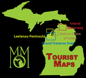
Coverage area
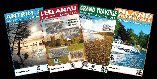
The areas currently available online are the Grand Traverse Area, the Leelanau Peninsula, the Antrim Chain of Lakes, and the Inland Waterway. Upcoming coverage areas include Little Traverse Bay and the Mackinac Straits.
|
|
|
|
How to get the paper tourist map
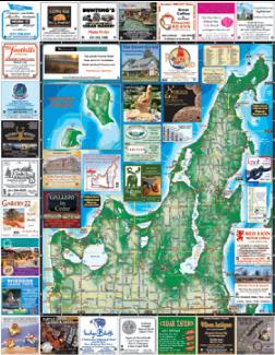
Need a paper version of this map? With each online map, you'll find a detailed list of businesses and public service centers where you can pick one up for free. Each location is also indicated on the map itself. You can also order a full set of our tourist maps here, sent to your door for only a penny, plus the cost of shipping and handling.
You'll find our paper publications to be affordable, full-color, high resolution, convenient in size, and easy to read. It's much less expensive to purchase a printed map or find a free tourist map near you than to spend several bucks for paper, ink cartridges, and tape, plus your time, to cobble together a fuzzy and unreadable map by printing from our online maps! Check our map store to view and order printed maps.
|
|